Monday, August 6, 2012

Flying Across America - Part VI

At last, civilization!  Or at least, what seems to be so when the basic criteria you apply is "has a taxi service".

We'd called ahead in our never ending quest for overnight hanger space and so the airport manager had kindly agreed to leave one side of the hanger open for us, but only with the strictest instructions about not blocking-in the air ambulance!

While waiting for the taxi to arrive to take us to a nearby hotel (we were only 5 miles outside of Blythe) I heard some odd engine notes in the background and went to see what was happening.

A Pair Of Ospreys Landing Near Blythe, CA

It turned out that a flight of three Ospreys set up an approach and landing into the desert just north of the airstrip.  I've seen them on the ground as s static display, but never before when operational.  I know that the development process for these aircraft was immensely challenging, but they really are an impressive site, especially as they transition from one flight mode to the other.

Taxi; hotel; Sizzler; bed.  Another of those exciting on-the-road kind of nights, then!  Honestly, by that stage, and remembering we'd just flown 8.7 hours for five legs, all in desert heat, all I cared about was air-conditioning and sleep.

07:00 and the sole taxi (same car, same driver) was back at the hotel, and we were soon back at Blythe airport.  With luck and a final push, today should see us back at home base.

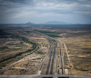
For the first leg, we aimed to do Blythe (BLH) to Barstow-Daggett (DAG).  Working through it the night before, our best option this time was to follow an old railway line north west through the desert before picking up another road, this time Route 40, to take us straight to Barstow.  With the early morning light filtering through some mid-level clouds, the desert & surrounding mountains looked beautiful as we flew across open territory.


The other joy about this sort of "off the beaten track" flying is that you come across really unexpected things, such as the small, inactive volcano and lava field we found here. Still, you can't also help pondering how long you'd have to wait for help in some of these areas if forced to set down.  (Note to self: get personal ELT beacon for next trip if aircraft doesn't have one installed!)


We made it to DAG in 2.1 hours, stopping again for fuel, weather briefing and water before tackling the next leg to Bakersfield (L45).  This would mean crossing over the lower-end of the Sierras and so we spent some time talking over the options.  However, it was already clear that one choice - the Tehachapi Pass - was off limits as the briefers warned us that a TFR was in effect due to fire-fighting operations.  Plan B was to head south towards I5 and the Grapevine, where we could either follow a VFR flyway (if it was easy to spot from ground references) or just go back to following the Interstate (also good as I had already checked the maximum altitude of the Grapevine before leaving home.)

Approaching The Grapevine (The Quarry Is A VFR Landmark)

Once again, Mother Nature was exceedingly kind to us.  Not only was visibility excellent. but the winds were light and so we crossed the Sierra ridge-line with barely a ripple.  Bakersfield was not far off, fuel looked good, and for the first time we caught sight of the Pacific.

We landed at L45 after 1.9 hours, found the self-serve 100LL and then - even better - we found the airport had a cafe (and a very nice one to boot!), albeit at the other end of the airfield.  I have to say though, it felt slightly decadent firing 2SA up again just to taxi from the fuel pumps to the cafe, where we were delighted to find helipad markings on the apron out front; just 'cos, that's where we therefore parked!

Reviewing the charts, and based on the performance we'd measured to date, we had a shot at doing the remaining part of the trip in one shot - L45 to WVI.  It would be tight fuel-wise, but do-able.  And of course, since we were now on home turf, we had a good idea of places to get fuel along the way if needed.  Therefore, that became the plan of record: head west; cross over the hills between I5 and Paso Robles; head north-west up 101 via King City, and from there it's a straight shot into the Monterey area and home.

Now, however, things changed a little.  We picked up a 20 knot headwind and hence our speed dropped and fuel consumption rose.  We got as far as Salinas (SNS) just as the auxiliary tank showed empty, a situation that ought to have left us with fuel for around 50 minutes flying.  Bearing in mind a) we didn't have that much experience of 2SA's fuel gauge accuracy, b) we still had those pesky headwinds, c) by law we had to land with a minimum of 20 minutes fuel remaining, and d) as Wendy rightly pointed out, we now ran the risk of catching "get home-itis", we decided to set down in Salinas for a splash-and-dash at the helipad; we'd been after flying for 2.7 hours by this point.

Moss Landing

Final leg - SNS to WVI. Adding in the final 0.4 hours for SNS-WVI gave us a grand total of 36.0 hours for the entire trip.  After covering some 2,400 nm in 4.5 days, we were finally home!


A huge shout-out to Wendy, without who I would't have even thought about doing it.  Kudos, too, to N622SA.  She never missed a beat, and settled-in to her new home very quickly, starting to earn her keep the very next day.

An epic journey was now over, and so many thanks to all concerned for both giving me the opportunity to make it, and for helping us to do so safely.  Yes, it was a tiring and, as my shoulder will attest, sometimes painful flight, but I'd do it all over again in a heartbeat!


Sunday, August 5, 2012

Flying Across America - Part V

Dawn Roll-Out. Van Horn, Texas

Another early start; another morning not quite sure how we'd get back to the airfield.  Fortunately, the hotel manager very kindly proved the thesis that, thanks to evolutionary imperatives and human social development we are all by nature altruistic, by agreeing to be woken up early just to get us back there!  Note to self: must be a lot of opportunities for setting up local private taxi services over the web, especially in smaller towns where more formal arrangements just don't exist.  Hmm, actually, that's not a bad idea at all ...

(Just as an aside, we asked what brought an enterprising young man like himself to such a - shall we say, "remote" - part of Texas?  He explained that there was a plan to open a natural gas well, i.e. a fracking project, about 100 miles north and that, as this was the nearest town, some very good times lay ahead for the hotels & other businesses in Van Horn.  Fair enough, and we both wished him every success.)

A long day was ahead of us.  Since the weather remained so weirdly storm-free, we decided to press-on to see if we could make it into California. As the crow flies, that would be something like 520 nm; alas, we would have to take a slightly more meandering route in order to a) avoid major peaks, and b) avoid a major incident by accidentally crossing over the border into Mexico.  In addition, for the last day or so I had been suffering from increasing pain emanating just behind the right shoulder blade.  It was just a by-product of holding the controls for hours-and-hours a day and only flared up after about the first hour of flying, but I can't say I was looking forward to it returning on what was now day four of the trip.  (However, I'm not the only one to feel like this on a long R22 trip, as was very well explained by Philip Greenspun : "When folks ask me for a short summary of my trip from Los Angeles to Boston in a brand-new R22, I say "For the first day, I was worried that I was going to die. On the fifth and sixth days, I was worried that I wasn't going to die." Sitting bolt upright, a bit tense on the controls, hour after hour, is not very comfortable.")

Back to following the same road once again, but now, as we started to climb, desert was giving way to desert-plus-hills, which at least improved the view!  This first leg would take us through El Paso and the controller kindly allowed us to continue to follow the Interstate and hence to get a good view of downtown and, immediately over I10, of Mexico!

Downtown El Paso

After 1.9 flying hours we landed in Las Cruces, NM (LRU) just in time to see two military helicopters taking off from the apron there.  (Fort Bliss is a major army base sitting just east of El Paso, and of course border control activities must drive a lot of additional helicopter operations as well.)  Wendy reminded me that big-rotors = big-downwash, so we jinked around a little in order to steer clear of the big-boys' toys!  More fuel, more weather briefings and then back to it: next stop, Lordsburg, NM (LRU).  We planned for a shorter legs here in order to recognise both the increasing density altitudes we were seeing (maxing out at 6,800') and fewer alternate airports on the map.

From Lordsburg (1.2 hours from LRU) we headed next for Benson Municipal (E95), a leg that got us out of New Mexico into Arizona, and a further 1.3 hours clocked-up on the Hobbs.

At Benson we were able to pick up another quart of 100W Plus oil, something that wasn't always available at every stop but which we kept an eye out for as we were using just under a quart a day.  We also saw an old Douglas R4D-8 aircraft, standing out  a bit from the usual clutch of Cessnas, Mooneys etc. you'd expect to find parked-up on airports such as this.


Seems that someone bought it at a drug-auction after it was seized by the US authorities, with the idea of re-fitting it for commercial operations; apparently, that was quite a few years ago now, so no one I talked-to was sure if she would ever fly again.

Next up, a longer flight to Phoenix Goodyear (GYR) where we'd take stock to see if a "one more leg and we're in CA" push made sense.

Phoenix Bound

To reach GYR in such a way that we could continue following the Interstate meant we'd be getting too close to class Bravo airspace around Phoenix Sky Harbor, the main airport there.  Therefore, we planned to leave I10 about 15 miles south of PHX and fly northwest straight to GYR.  This would entail figuring out between the charts and what we could see out the windows, which was the big ridge we'd need to fly around the south of in order to make this work.  Well, we ended up going a bit too far up I10 and having the controller point out that we couldn't fly any closer to PHX, and so would we mind making an immediate left turn? Ooops.  No big deal though, we'd been with flight following and PHX approach control all the way-in from something like 50 miles out, and therefore they had us on their radar screens the whole time, despite us flying a lot lower than pretty much everything else they were tracking. On the plus side, however, we got a great view of Sky Harbor airport!

Getting into GYR after that was fine, at least it was once we'd figured out where they'd hidden the helipad and dealt with the strong, gusty winds that had blown up.  After taking a break, taking stock and taking some more rest time, we elected to press on and to go for crossing-off one more state on our list.  GYR to E95 had been a fairly stressful 2.2 hours but thanks to gaining a timezone and starting early, we were doing OK timewise.  California, here we come!

The Sierra Nevada Mountains Hove Into View

At last, we could finally allow ourselves the luxury of thinking we could actually get this whole trip done in under 5 days. By running five legs across three states, day four saw us flying 8.7 hours over what was at least a 12 hour day.  We were therefore really happy to see the Colorado River, marking as it does the Arizona-California border, slip by under 2SA, and even happier a few miles later to be landing at Blythe airport.  A very long day, but one that set us up for making it home in time for tea on day 5!

Flying Across America - Part IV


Here's where 622SA got to spend the night. $50 got her rather deluxe accommodations as I think you'll agree, but, in the words of Bob Dylan, it was indeed the "shelter from the storm" which we needed to find (though never actually needed anywhere along the whole route). Anyway, the entire crew got a decent nights rest and we were back at it by 07:30.

Today would be the day we'd try and get through Texas, though realising it's going to be a long, hot and largely dull journey, characterised nicely by the mantra "follow that road", in this case, I20.

Sometimes, "Follow That Road" Gets A Bit Tricky To Implement

First stop was Abilene Regional (ABI), a 2.4 hour leg, and from there to Big Spring (BPG), a quicker 1.5 hour hop that we cut a bit short in order to get down to the ground for fuel (we could have flown longer) and a rest-room break (oh no we couldn't!)  Along the way - at least for the first part of the day - there was stuff to see and green to be found .... which is of course why I turned this picture of windmills north of I20 into B&W.


In addition to being a very welcome sight (as explained above), Big Spring was a great little airport; very nice terminal, good facilities and an interesting history.  Turns out it was an ex-army airfield, first opened in 1942 to train bombardiers in high altitude, precision bombing.  It closed in 1945 but then got a second lease on life in 1952 when the Korean war required additional training facilities to come on line to supply increasing numbers of fighter pilots. A couple of Fifties-era aircraft remain on the apron and it looks like there is a fairly decent aviation museum on the airfield somewhere too.

Even Airplanes Have A Pecking Order

Rested and re-hydrated, it was time to move on. However, the heat was starting to build and the wind was getting stronger too.  One - the wind - is easier to live with than the other.  The six legs from ABI onwards all saw density altitude readings over 5,000 feet, with the highest reported as being 6,800'. Therefore, take-offs and landings had to be executed with more care and finesse than ever as, especially at full-up gross weight, we now didn't have much of a power reserve to play with.

Now we were firmly in trucking country, over-flying multiple logistics depots along the side of I20.


Next up was Pecos Municipal (PEQ, 1.6 hours from BPG) where the temperature gauge read 43 Celsius on landing ... and only a little bit of that was down to heat from the tarmac and engine; suffice to say, it was damnably-hot out there.  Someone came out to meet us in a golf cart and, once we parked-up and shut down, brought across a fuel tanker.  We asked for an amount of fuel we though the aircraft would take and that would get us comfortably to the next stop but without carrying the extra weight of completely topping-off the tanks.  Just as we were collecting our things to head inside to plan the next leg, we suddenly saw a cascade of 100LL running down the back of the aircraft - you know, the bit with the hot engine, still-pinging exhausts and all .... Turns out, the chap manning the fuel truck didn't realise that we had twin tanks, and that to get the quantity of fuel requested would mean filling both sides, not just one.  (The tanks cross-feed, but that doesn't happen fast enough to automatically compensate for the rate of fuel flow from a pressurised delivery system.)  Fortunately, nothing caught fire and so we avoided the spectacle of seeing what a Robinson R22 would look like fully-engulfed in flames. ("Depressing" would be what I'd expect the answer to be.)  Lesson learned, and so from then on we made sure that, where fuel was served, vs. being a self-service stop, when I was the one with that particular job, those with the big nozzle in their hands understood how things worked in an R22!

One final push would see us reach Culberson County airport, Van Horn, where we'd call it quits for the day.  Actually, things worked out well in that regard because the next leg would see us start to climb in altitude and hence would be better tackled earlier the next day, when things were cooler.  It also meant that tomorrow we'd pick-up in Texas, and our first set-down of the day would be in New Mexico - the Lone Star State would finally be behind us!

Wednesday, August 1, 2012

Flying Across America - Part III


Another day, another few states to check off.

While things were still relatively cool, we elected for an early start.  We'd fuelled-up the night before so once we'd snagged a lift the few miles back to the airport from the hotel, done our pre-flights and repacked our chattels, time for the off once again. The goal for today was to get into Texas, preferably as far as Dallas but otherwise over the border somewhere.  Planned route was Weedon Field, Eufaula (AL) to Demopolis (AL), from there to Hawkins Field, Jackson (MS), to Shreveport Downtown, (LA) and finally hitting Dallas Executive (TX) where options were very good for hanger space overnight and a decent hotel nearby.


Demopolis must have been about the smallest airport we hit all trip, but had the essentials of a) 100LL fuel, b) a bathroom and c) water (for the pilots).  Of course, at each stop we also got an updated weather briefing and checked the charts so we knew what to expect, where, and when.  And just as importantly, we took the opportunity to un-knot ourselves from holding the controls or generally being stuck in a very small space for hours on end.  (I wanted to do as much of the flying as possible and so Wendy got the short end of the stick by having to handle charts, airport directories and GPS systems - plural.  More of that in a minute.)

Demopolis Airport Terminal!

Somehow or another, we managed both to make good time (a tailwind helped) and avoided any hint of bad weather.  The ground rolled away beneath us and, unlike what we were going to be seeing the next day, remained fairly green, lush and interesting.

Plant For Processing Something, Somewhere In Mississippi

I mentioned the need for more than one GPS?  Turns out the installed unit in the helicopter had two issues: one expected, one not.  As is common, the Garmin unit in the panel had information loaded for the south-eastern part of the USA, hardly surprising given that's where it was based. Even so, it looked like we could get routes through to about mid-Texas, but not much further.  Wendy was already on top of the problem because she'd seen it before and so had borrowed a Garmin 496 to bring with us.  This turned out to be a double bonus because we found that, after the first day or so of use, the panel system's display washed out, rendering it almost invisible.  Golden rule?  You can never have too many backup GPS platforms!  (I had my iPad with me which was the second line of defence.  Trust me - charts are great and remain indispensable, but for basic navigation then nothing beats being able to follow that magenta DTK line!)

Maps Doing One Other Thing GPS Can't: Being A Sunshade!

By now it was becoming a very long day.  Having reached Shreveport, crossing the Mississippi River from Louisiana along the way, we'd already been in the air 6.4 hours, the last leg alone being 2.5 hours long.  But, Texas was calling!  (I think it said "moo", but couldn't be sure.)

One final push saw us complete the Shreveport to Dallas Executive leg in a further 2.1 hours.  Ultimately, the fact that the weather was clear with no convective activity in the area sealed it - there just aren't that many windows to fly a whole day in this part of the country in July without encountering thunderstorms and so we elected to make full use of the daylight and benign skies.  However, the FBO at Dallas Executive was a very welcome sight, as was the Hampton Inn a few miles away!  8.5 hours air-time is quite tiring, but we'd made real progress and were cracking-on a treat.  Time to get some sleep.